Find the fatal flaw before anyone signs.
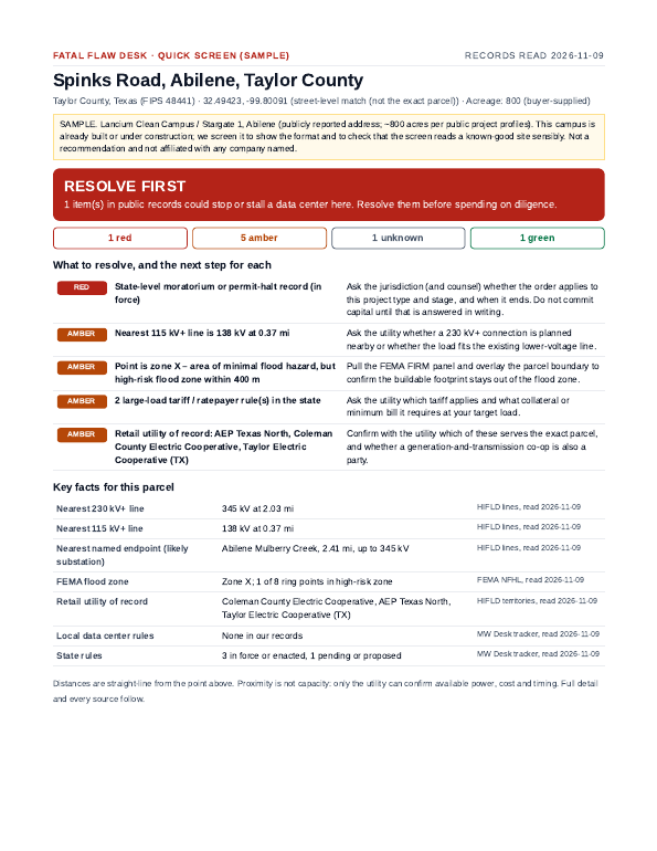
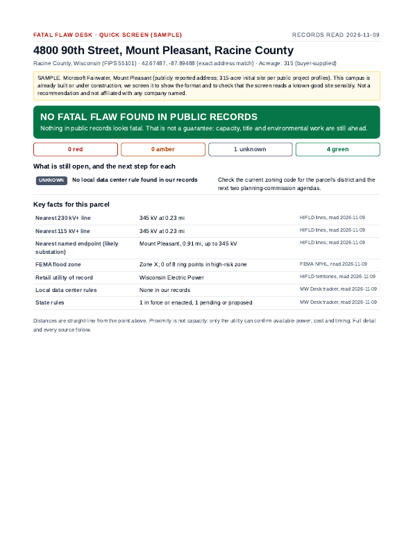
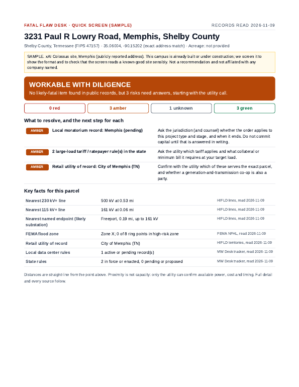
Send us a US parcel. Within 24 hours you get a sourced screen: nearest mapped transmission lines and substations, FEMA flood zone, local and state data center rules and moratoria, the utility on record, a red-flag list and the questions to ask the utility.
Independent: we don't buy land, list it, or take a commission. Built for land brokers, developers, landowners and economic development teams.
What a Quick Screen checks
Power proximity
Distance and voltage of the nearest mapped lines (115 kV to 765 kV) and named substations, with the owner of record and a map.
Flood
FEMA flood zone at the point plus a ring test around the site for nearby high-risk zones.
Rules and moratoria
County, city and state data center moratoria, ordinances, large-load tariffs and water rules on record, each linked to its source.
What we can't know
Capacity, fiber, water supply, wetlands and title aren't in public maps. We say so and give you the exact questions to ask.
Sample screens
Three publicly reported campuses, screened by the same engine you'd buy.
Pricing
Broker Desk
Up to 12 Quick Screens a month for brokers and developers screening inbound parcels.
SubscribeSite Record
One site in depth, 72 hours: neighboring-jurisdiction rules, pending hearings, tariffs, water, access and timeline risks.
OrderFree county snapshots
50 counties with data center rules and mapped transmission, sourced line by line.